
Usenge to Sanda Beach Road
Drive
checked 11 August 2026
- Distance
- 1.9km
- Climb
- 32m
- Est. time
- 0:05
Download the line
A GPX file with all 76 recorded points. It opens in Garmin, OsmAnd, Gaia GPS and Panya. It has the line only, with no turn guidance.
About this route
An unsealed lakeside drive from Usenge toward Sanda Beach in Siaya County.
Before you go
Some facts need a new check. We hide old amounts, permits, hours and contacts below.
When to go
Route-specific current-conditions profile
Stale, check again. OpenStreetMap route snapshot: Usenge to Sanda Beach Road, checked 10 August 2026. Source
Elevation
32 m up, 24 m down
1,140 m to 1,170 m. Estimated from the route line, not from recorded runs.
Along the way
- 0.0 km
Usenge to Sanda Beach Road start
Exact first point of the accepted full-resolution GPX.
- 1.9 km
Usenge to Sanda Beach Road finish
Exact final point of the accepted full-resolution GPX.
Route visuals

PhotographLove Nature and Protect your planet. Commons coordinates place this Lake Victoria view near the route area; the exact road or Sanda Beach is not identified.
Photo by Ennocent Emmanuel · captured 2020-07-18
File:Lake Vic.jpg by Ennocent Emmanuel · CC BY-SA 4.0

Changes: Resized, re-encoded, and composited on a blurred background by Panya Routes on 2026-08-11
Adaptation license: CC BY-SA 4.0
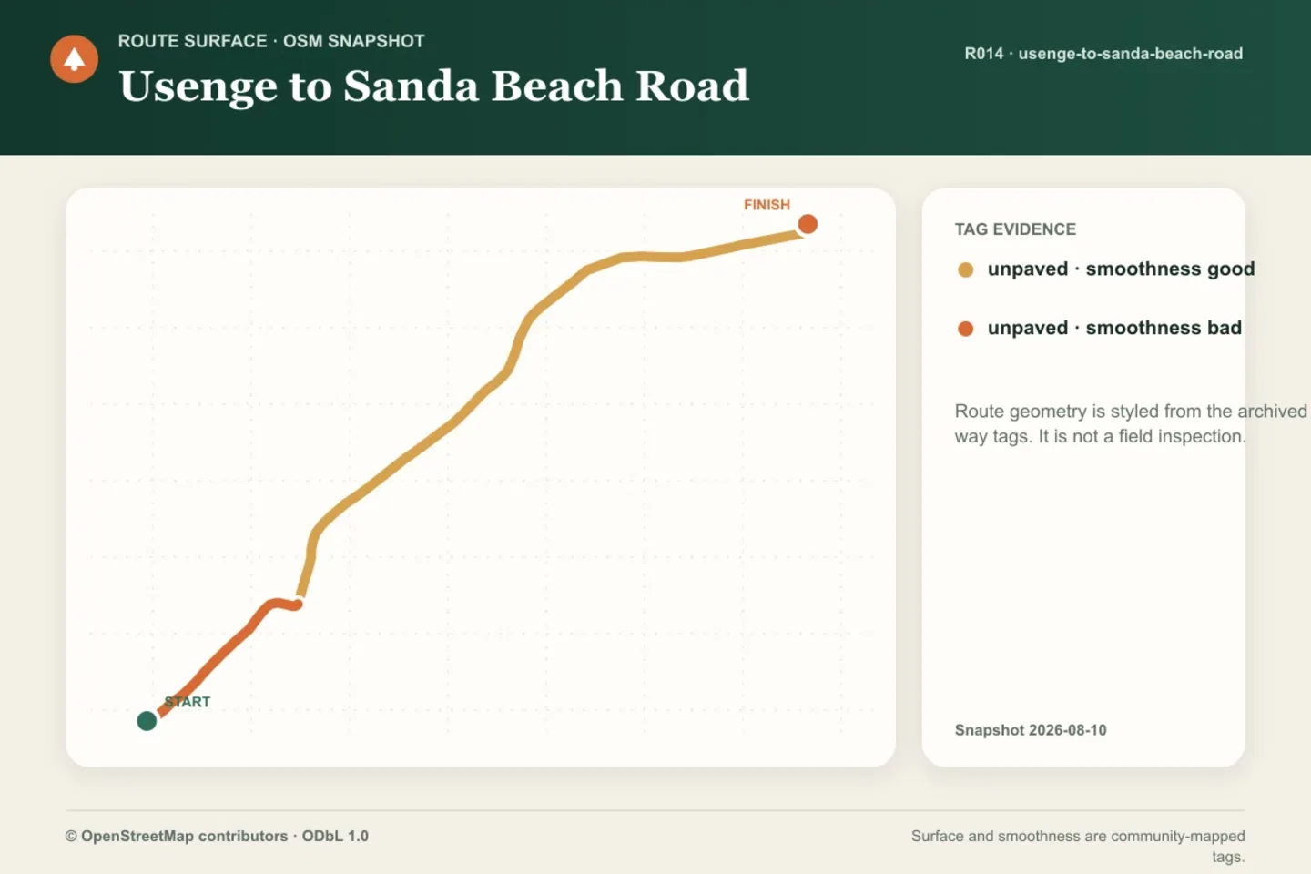
GraphicArchived OSM surface and smoothness tags along the accepted route geometry. Tag evidence is not a current field inspection.
Created by Panya Routes data graphics · generated 2026-08-11
Method panya-route-data-graphic-v1. Shows archived route geometry and OSM way tags only.
Source archive: © OpenStreetMap contributors · ODbL 1.0 · source date 2026-08-10
© OpenStreetMap contributors by © OpenStreetMap contributors · ODbL-1.0
Changes: Rendered into a route data graphic by Panya Routes on 2026-08-11
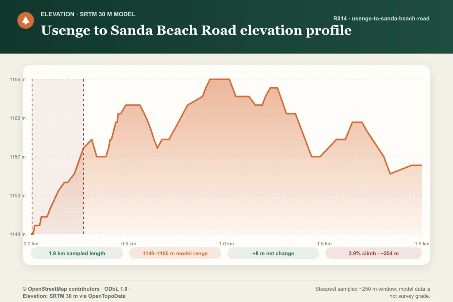
GraphicSRTM 30 m model profile. The highlighted 3.9% climb is the steepest sampled approximately 250 m window, not a field-surveyed grade.
Created by Panya Routes data graphics · generated 2026-08-11
Method panya-route-data-graphic-v1. Shows modeled elevation and a reproducible sampled-window calculation; it does not assert current passability.
Source archive: © OpenStreetMap contributors · ODbL 1.0 · source date 2026-08-10
Source archive: Elevation: SRTM 30 m via OpenTopoData · source date 2026-08-10
© OpenStreetMap contributors by © OpenStreetMap contributors · ODbL-1.0
Changes: Rendered into a route data graphic by Panya Routes on 2026-08-11
SRTM 30 m via OpenTopoData by SRTM 30 m via OpenTopoData · USGS-PUBLIC-DOMAIN
Changes: Rendered into a route data graphic by Panya Routes on 2026-08-11
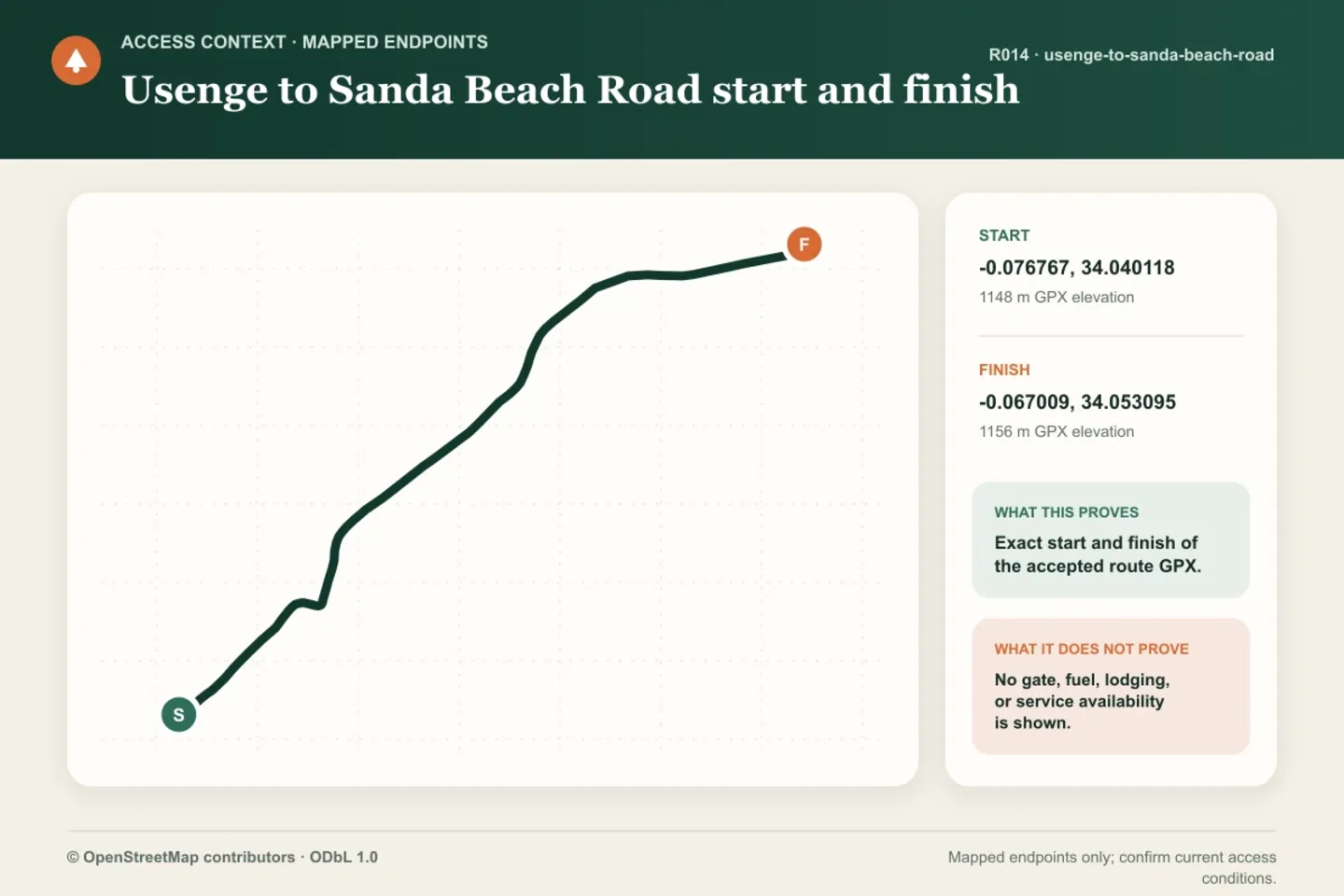
GraphicMapped route endpoints only. This graphic does not show or claim gate, fuel, lodging, transport, or service availability.
Created by Panya Routes data graphics · generated 2026-08-11
Method panya-route-data-graphic-v1. Shows accepted GPX start and finish only; no service-availability claim.
Source archive: © OpenStreetMap contributors · ODbL 1.0 · source date 2026-08-10
Source archive: Accepted full-resolution route GPX endpoints
© OpenStreetMap contributors by © OpenStreetMap contributors · ODbL-1.0
Changes: Rendered into a route data graphic by Panya Routes on 2026-08-11
Can your vehicle do this?
Add your vehicle in the app to get the answer. Download the route before you lose signal.