
Download the line
A GPX file with all 129 recorded points. It opens in Garmin, OsmAnd, Gaia GPS and Panya. It has the line only, with no turn guidance.
About this route
A rough rural drive between Roga and Marani, including difficult unsealed sections.
Before you go
Some facts need a new check. We hide old amounts, permits, hours and contacts below.
When to go
Route-specific current-conditions profile
Stale, check again. OpenStreetMap route snapshot: Roga to Marani Road, checked 10 August 2026. Source
Elevation
219 m up, 28 m down
1,450 m to 1,700 m. Estimated from the route line, not from recorded runs.
Along the way
- 0.0 km
Roga to Marani Road start
Exact first point of the accepted full-resolution GPX.
- 3.7 km
Roga to Marani Road finish
Exact final point of the accepted full-resolution GPX.
Route visuals
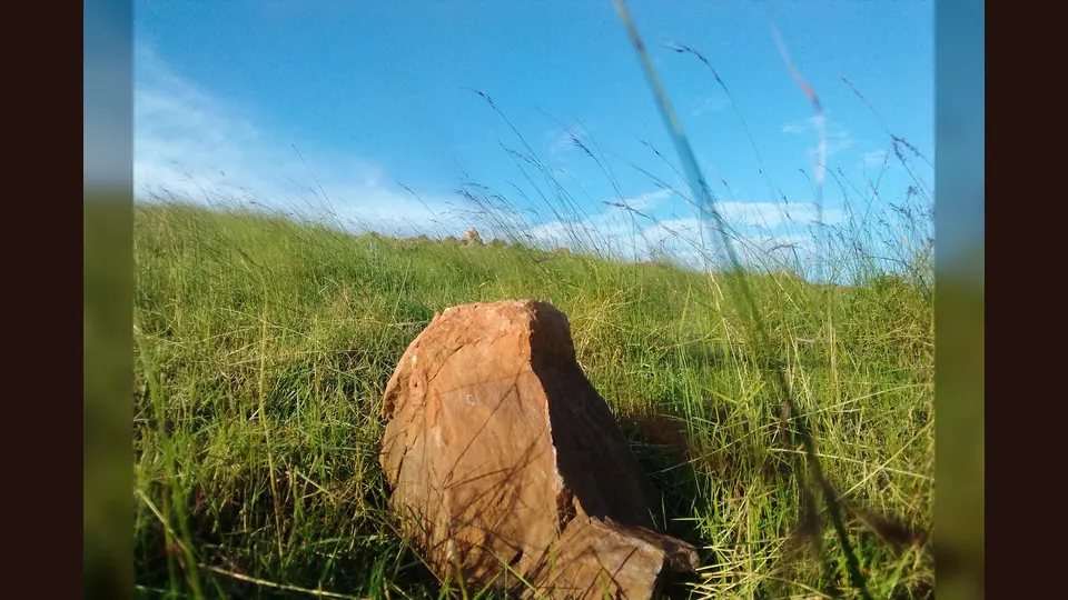
PhotographThe iconic manga hills where the natives are collecting stones for sale. Facing Kisii town a very iconic place to visit and spend your time.. Commons coordinates place this at Manga Hills near Kisii; it is regional landscape context, not the Roga–Marani road.
Photo by Moire Dr. · captured 2020-07-09
File:Manga Hills landscape.jpg by Moire Dr. · CC BY-SA 4.0

Changes: Resized, re-encoded, and composited on a blurred background by Panya Routes on 2026-08-11
Adaptation license: CC BY-SA 4.0
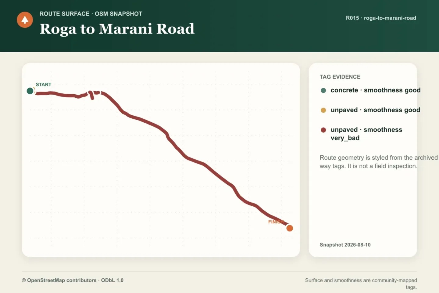
GraphicArchived OSM surface and smoothness tags along the accepted route geometry. Tag evidence is not a current field inspection.
Created by Panya Routes data graphics · generated 2026-08-11
Method panya-route-data-graphic-v1. Shows archived route geometry and OSM way tags only.
Source archive: © OpenStreetMap contributors · ODbL 1.0 · source date 2026-08-10
© OpenStreetMap contributors by © OpenStreetMap contributors · ODbL-1.0
Changes: Rendered into a route data graphic by Panya Routes on 2026-08-11
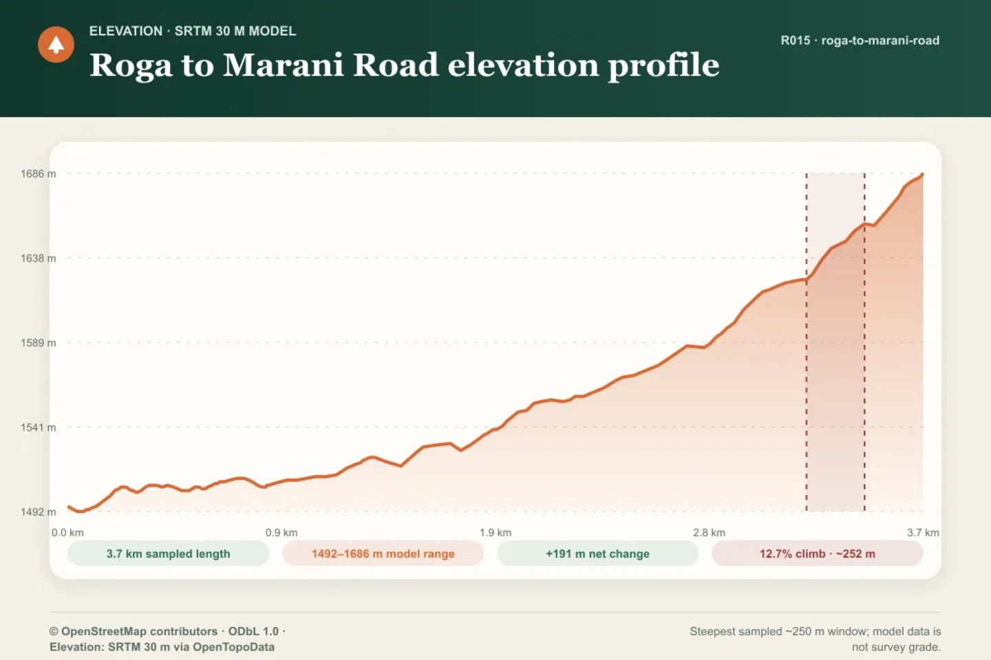
GraphicSRTM 30 m model profile. The highlighted 12.7% climb is the steepest sampled approximately 250 m window, not a field-surveyed grade.
Created by Panya Routes data graphics · generated 2026-08-11
Method panya-route-data-graphic-v1. Shows modeled elevation and a reproducible sampled-window calculation; it does not assert current passability.
Source archive: © OpenStreetMap contributors · ODbL 1.0 · source date 2026-08-10
Source archive: Elevation: SRTM 30 m via OpenTopoData · source date 2026-08-10
© OpenStreetMap contributors by © OpenStreetMap contributors · ODbL-1.0
Changes: Rendered into a route data graphic by Panya Routes on 2026-08-11
SRTM 30 m via OpenTopoData by SRTM 30 m via OpenTopoData · USGS-PUBLIC-DOMAIN
Changes: Rendered into a route data graphic by Panya Routes on 2026-08-11
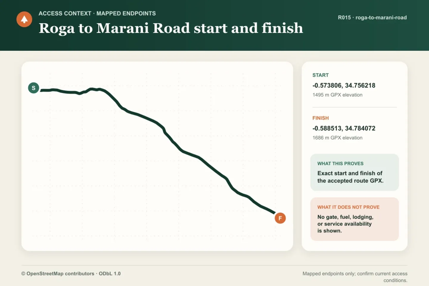
GraphicMapped route endpoints only. This graphic does not show or claim gate, fuel, lodging, transport, or service availability.
Created by Panya Routes data graphics · generated 2026-08-11
Method panya-route-data-graphic-v1. Shows accepted GPX start and finish only; no service-availability claim.
Source archive: © OpenStreetMap contributors · ODbL 1.0 · source date 2026-08-10
Source archive: Accepted full-resolution route GPX endpoints
© OpenStreetMap contributors by © OpenStreetMap contributors · ODbL-1.0
Changes: Rendered into a route data graphic by Panya Routes on 2026-08-11
Can your vehicle do this?
Add your vehicle in the app to get the answer. Download the route before you lose signal.